Flood
Property
Weather
- Address N/A
- Latitude N/A
- Longitude N/A
Select an address below to see the elevation information within an 50 foot radius of the 911 address point.
- NOAA NEXRAD RADAR (latest image)
- Current Warnings
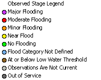
- Observed River Stages
- Significant River Flood Outlook
- Snow Water Equivalent
Snow Water Equivalent
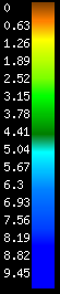 National Operational Hydrologic Remote Sensing Center. 2004. Snow Data Assimilation System (SNODAS) Data Products at NSIDC. Snow Water Equivalent. Boulder, Colorado USA: National Snow and Ice Data Center. doi: https://doi.org/10.7265/N5TB14TC
- LatitudeN/A
- LongitudeN/A
- ElevationN/A
- DatumN/A
- Flood ZoneN/A
- CountyN/A
- Political AreaN/A
- Effective DateN/A
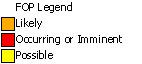
Flood Risk Comparison
- 10% Annual ChanceN/AN/A
- 4% Annual ChanceN/AN/A
- 2% Annual ChanceN/AN/A
- 1% Annual ChanceN/AN/A
- 0.2% Annual ChanceN/AN/A
Download Data
Print Map
- LatitudeN/A
- LongitudeN/A
- ElevationN/A
- DatumN/A
- Flood ZoneN/A
- CountyN/A
- Political AreaN/A
- Community IDN/A
- Panel NumberN/A
- FIRM Effective DateN/A
- Jurisdictional AuthorityN/A
- 1% Annual Chance N/A
85.4ft
Flood Depth:
2.5ft
2.5ft
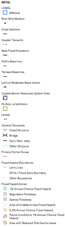
 Floodway
 1% Annual Chance
 0.2% Annual Chance
Show Full FEMA Legend
Download Data
Print Map